
A Flutter app (Android / iOS / Web) that tells you the best days to go ant collecting. It downloads the weather at your location and estimates the likelihood that queen ants are undertaking their nuptial (mating) flights near you — today and for the next week. When the percentage is high, it's time to get outside and look for ants in your local area!
- Web app: https://nuptialflight.app/
- Source: https://github.com/bradrushworth/nuptialflight
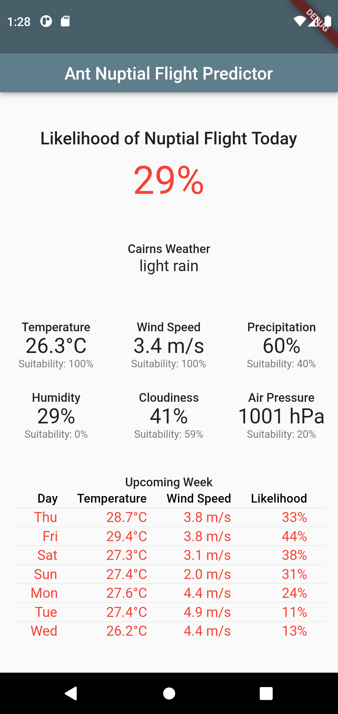
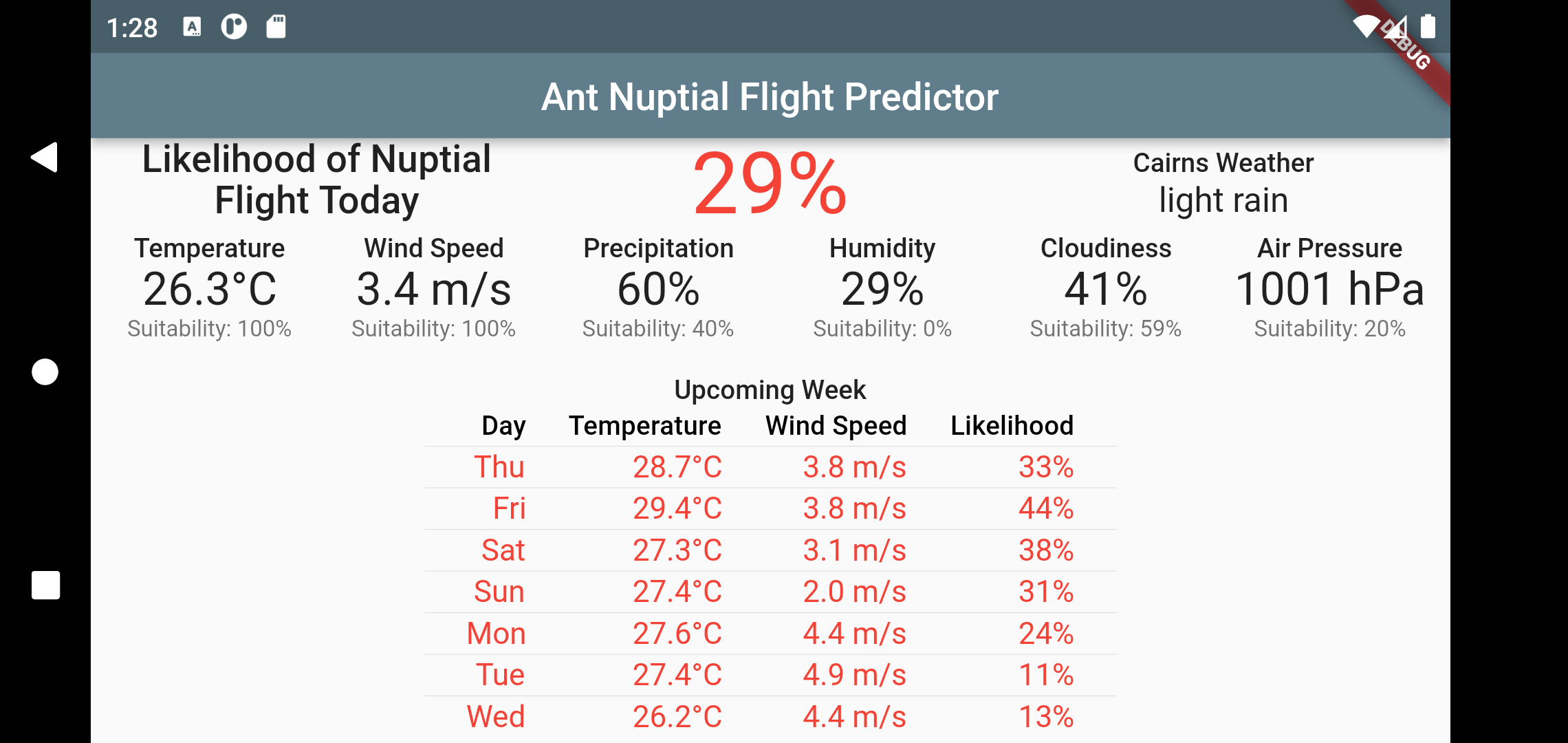
- Daily & hourly flight forecasts — a colour-coded percentage (red/amber/green) for each of the next 7 days and for each hour of the current day, showing when conditions are right for queens to fly.
- Location-aware — uses your device GPS (or last-known position) to fetch local weather. You can also pick a place with the built-in Google Places search.
- Weather-driven model — the forecast is computed from current + historical weather (temperature, humidity, wind, pressure, rain) using a trained Random-Forest model (see The Science below).
- Crowd-sourced reports — users can report a nuptial flight they observed. Reports are stored in a backend database (ArangoDB) and shown back to other users nearby ("X flights reported near you"). Each report is tagged with an anonymous install id (a random UUID generated once per install, stored locally via shared_preferences; see lib/controller/install_id.dart) so bursty or abusive reports can be de-duplicated without tracking the device or user.
- Per-size seasonal likelihood — the main screen shows, under the date and weather line, whether a flight is likely today and which queen-size class (small/medium/large) is most likely right now, using a data-derived seasonal prior (different size classes peak in different months), so keepers hunting a specific species get species-appropriate timing.
- Background updates & notifications — a background-fetch task periodically recomputes the percentage and can post a notification when the local flight chance is high, or when nearby users report a flight.
- Home-screen widget (Android) — a glanceable widget showing today's flight percentage, updated by the background task.
- Map view — an interactive map (OpenStreetMap tiles via
flutter_map) where you can explore weather layers and reported sightings. - Light / dark theme — follows the system theme.
- Device-preview — in debug (non-release) web builds,
device_preview_pluslets you inspect layouts across device sizes.
- On launch,
main()initialises Flutter, sets up the home widget, and shows the app. Background services are started after the first frame (see First-load performance). _loadData()resolves the user's position:- fast passive
getLastKnownPosition(), falling back to an active GPS fix only when no cached position exists; - or a location chosen via the Google Places picker.
- fast passive
WeatherFetchercalls OpenWeatherMap for that position:- nearest weather station,
- historical (past-day) weather,
- current forecast.
Nuptialsscores the weather with two Random-Forest models (nuptialDailyPercentageModel,nuptialHourlyPercentageModel) to produce the daily and hourly flight percentages.ArangoDB(singleton) loads nearby user-reported flights and (optionally) persists new reports.- The UI renders the percentages, a 7-day list, an hourly breakdown, and the map.
API keys required (see Getting Started): an OpenWeatherMap key for weather, a Google Maps key for Places search, and an ArangoDB URL/credentials for report storage.
Ant queens mate on the wing in mass "nuptial flights" that are triggered by specific weather windows (warm, humid, calm, often after rain). The app originally encoded rules derived from the literature:
- Weather conditions during nuptial flight of Manica rubida
- The spatial distribution and environmental triggers of ant mating flights
- Weather Conditions During Nuptial Flights of Four European Ant Species
Newer versions of the app replace hand-written rules with data-science models —
Random-Forest classifiers trained on user-contributed sighting/weather data
(see the training notebooks lib/models/*.ipynb). The trained forests are
bundled as sklite-JSON assets (assets/final_model.json,
assets/hour_model.json) and scored at runtime by the hand-written
tree-walker lib/models/forest_model.dart (sklearn predict_proba
parity ~1e-14, verified by test/production_model_parity_test.dart).
The generated scoring trees expect features in a fixed order that matches the
training notebooks (lib/models/*.ipynb). The call sites in
lib/controller/nuptials.dart pass exactly these:
| Model | Asset | Inputs (in order) |
|---|---|---|
| Daily | assets/final_model.json (15) |
lat, lon, hemisphere, sin_doy, cos_doy, temp, wind, rain, humid, cloud, press, dewPoint, dew_dep, rain1, rain2 |
| Hourly | assets/hour_model.json (12) |
lat, lon, hemisphere, sin_doy, cos_doy, hour, temp, wind, humid, press, dewPoint, dew_dep |
The hourly model is trained without rain and cloud (as in earlier
versions) and adds the UTC hour. If you retrain a model
with a different feature set/order, update the call site in nuptials.dart and
the model tests (test/nuptials_test.dart, test/hourly_test.dart,
test/model_test.dart) to match.
A retraining effort against the live flights DB (212k rows, ~4.8% positives)
found that the production training config's ccp_alpha=0.0008 prunes every
tree to a single leaf under that class imbalance (AUC 0.500 - the model
predicts the base rate). An improved config (150 trees, depth 14,
class_weight='balanced_subsample', no ccp_alpha, plus cyclical
day-of-year, hemisphere, dew-point depression and antecedent-rain features)
lifts AUC to 0.663 and average precision from 0.048 to 0.110, verified by a
Dart/Python parity test (test/improved_model_parity_test.dart, max error
~1e-14). A compact variant (24 trees, max_leaf_nodes=128; daily AUC 0.643,
hourly AUC 0.668) is now shipped as the bundled JSON assets, scored by
lib/models/forest_model.dart. Full details and limitations (m2cgen cannot
export calibrated models) are in
docs/model_training_findings.md.
- Flutter SDK (the project pins
sdk: '>=3.9.2 <4.0.0'). - An OpenWeatherMap API key (free tier) — https://home.openweathermap.org/api_keys
- A Google Maps API key (for the Places location picker).
- (Optional) an ArangoDB endpoint + credentials for crowd-sourced reports.
- Clone and fetch dependencies:
git clone https://github.com/bradrushworth/nuptialflight.git cd nuptialflight flutter pub get - Create
assets/.envwith your keys, e.g.:(The exact variable names live inOPENWEATHERMAP_API_KEY=<your openweathermap key> GOOGLE_API_KEY=<your google maps key> ARANGO_URL=https://your-arango-host:8530 ARANGO_USER=<user> ARANGO_PASSWORD=<password> ARANGO_DB_NAME=<database>
lib/controller/weather_fetcher.dartandlib/controller/arangodb.dart— keep them in sync with the code. The code readsARANGO_PASSWORDandARANGO_DB_NAME(the namesARANGO_PASS/ARANGO_DBshown in older copies of this template are incorrect).assets/.envis gitignored, so real keys/passwords must never be committed.) - Run:
flutter run            # current platform
flutter run -d chrome # web
The following commands are used for packaging (run from the project root):
# Regenerate launcher/adaptive icons
flutter pub run flutter_launcher_icons:main

# Build an Android App Bundle for Play Store submission
flutter --no-color build appbundle

# (Legacy) sign the app widget automation step
flutter pub run flutter_automation --android-signflutter pub upgrade --major-versions # conservative major bumps
# or
flutter pub upgrade # latest within constraintsAfter upgrading, verify with flutter analyze (the project currently has 0
errors; only a few pre-existing deprecated_member_use info-hints remain in
lib/controller/screenshots_other.dart, lib/controller/widgets_mobile.dart,
and lib/utils.dart).
The first page shows a spinner until location + weather are fetched. To keep that fast, the startup path avoids blocking work:
initializeService()(background-fetch config + notification channels) runs afterrunApp()viaunawaited(...), so it never delays the first frame.- The notification-permission prompt is not awaited in
_loadData()— it is fired withunawaited(...)so the location/weather network calls start immediately. _getLocation()does a fast passivegetLastKnownPosition()first and only falls back to an active GPS fix when no cached position exists. This avoids fetching the 3 OpenWeatherMap endpoints twice on every launch.- The active GPS fix uses a 10-second
timeLimit(was 30s) so a first launch with no cached position cannot hang for half a minute.
OpenWeatherMap responses are now cached in shared_preferences (keyed by rounded
lat/lon, so a real move invalidates the cache) with per-endpoint TTLs: 30 min for
current/forecast, 24 h for reverse geocoding, 30 days for historical. Repeat
launches and the 15-min background fetch reuse a fresh-enough response, cutting
paid OWM API calls.
lib/
  main.dart                 # App entry, MyHomePage UI, load/weather flow
  utils.dart                # Shared helpers
  controller/
    weather_fetcher.dart   # OpenWeatherMap calls + location lookup
    nuptials.dart          # Random-Forest scoring of weather -> percentages
    services.dart           # Background-fetch + notifications + widget updates
    arangodb.dart          # ArangoDB singleton: reports & nearby flights
    screenshots_*.dart    # Screenshot/device-preview plumbing (mobile vs web)
    widgets_*.dart         # Platform widget glue (mobile vs web)
  models/
    forest_model.dart      # RandomForest predict_proba walker (reads JSON assets)
    *.ipynb               # Training notebooks (Random Forest)
  responses/              # JSON response model classes (OWM, geocoding)
  view/
    map.dart               # Standalone interactive map page
assets/
  .env                    # API keys (not committed)
  final_model.json        # Bundled daily model (sklite JSON, 24-tree RF)
  hour_model.json         # Bundled hourly model (sklite JSON, 24-tree RF)
test/                     # Unit/widget tests (flutter test)
Code originally forked from https://github.com/ashgarg143/AppWidgetFlutter
Thanks for the Ant Icon by Vladyslav Severyn on Iconscout.